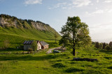
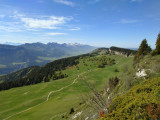
Découvrez la Molière, son refuge et son alpage
- Itinéraire de Randonnée Pédestre
In brief
- Level red – hard

- Route 577
- Distance (km) 15
- Route 639
Autrans
 Departure/Arrival
 Point of interest
Information
Découvrez la Molière, son refuge et son alpage
Autrans
38880
Autrans-Méaudre en Vercors
Phone : +33 4 76 95 42 62
General information
- Environnements :
- Forest location
- Mountain location
- Natures terrain :
- Stone
- Ground
- Passages delicats :
- Pas de passage délicat
- Period :
- Spring
- Summer
- Autumn
- Restaurants :
- Restaurant
- Pedestrian sports :
- Hiking itinerary
- Pedestrian sports
- Localisation :
- Autrans
Facilities, Services
- Parking :
- Car park
- Free car park
Presentation
From 01/05 to 30/09 daily.
Pics
Pics


We also suggest...


-
- Itinéraire de Randonnée Pédestre
-
- Route 655
- Distance (km) 15
- Route 663


Autrans

-
- Itinéraire de Randonnée Pédestre
-
- Route 197
- Distance (km) 10
- Route 98


Méaudre
-
- Itinéraire de Randonnée Pédestre
-
- Route 505
- Distance (km) 9
- Route 307


